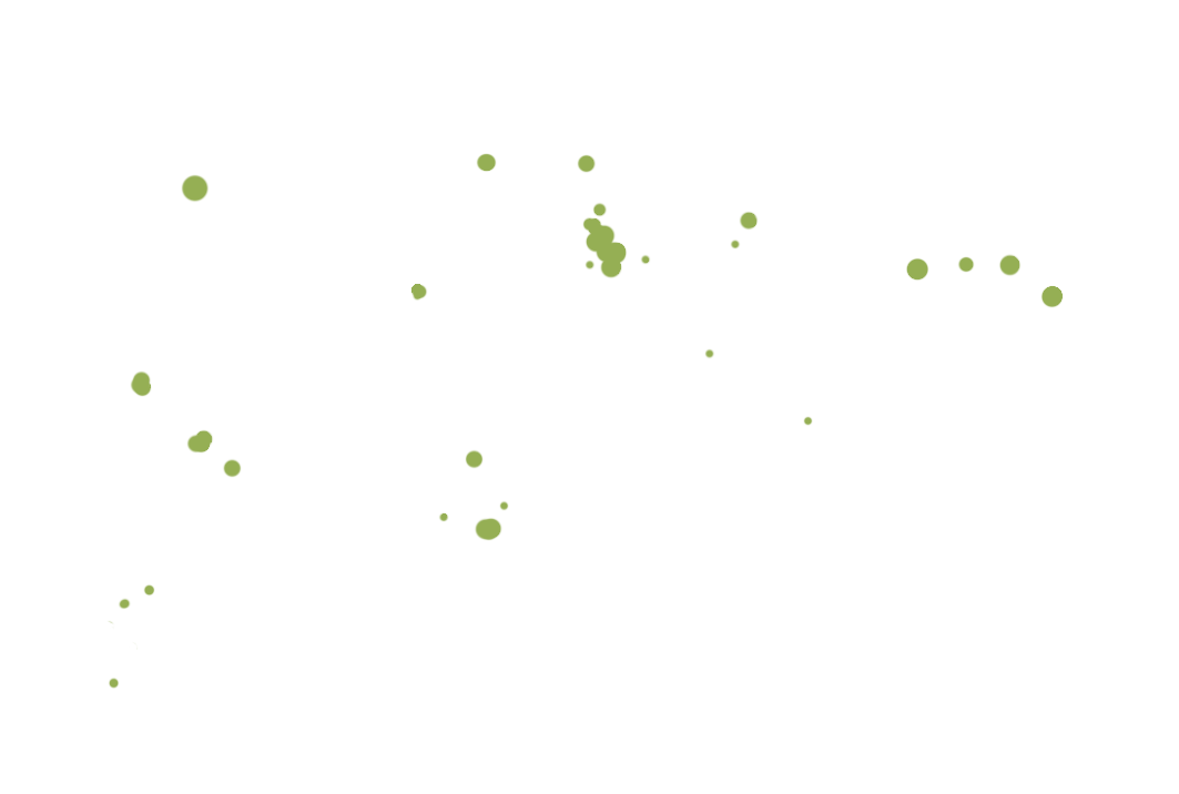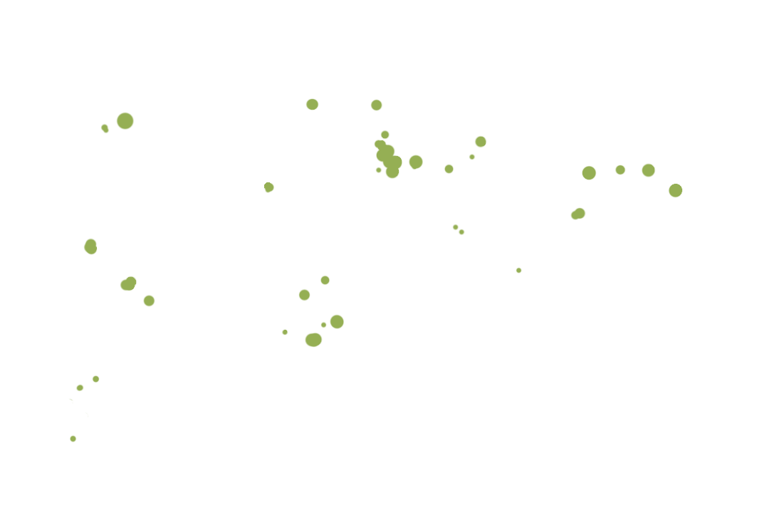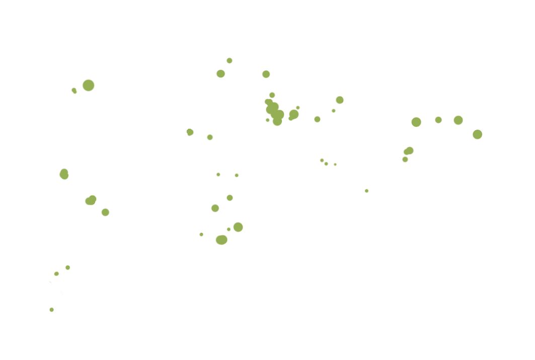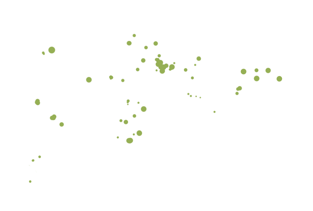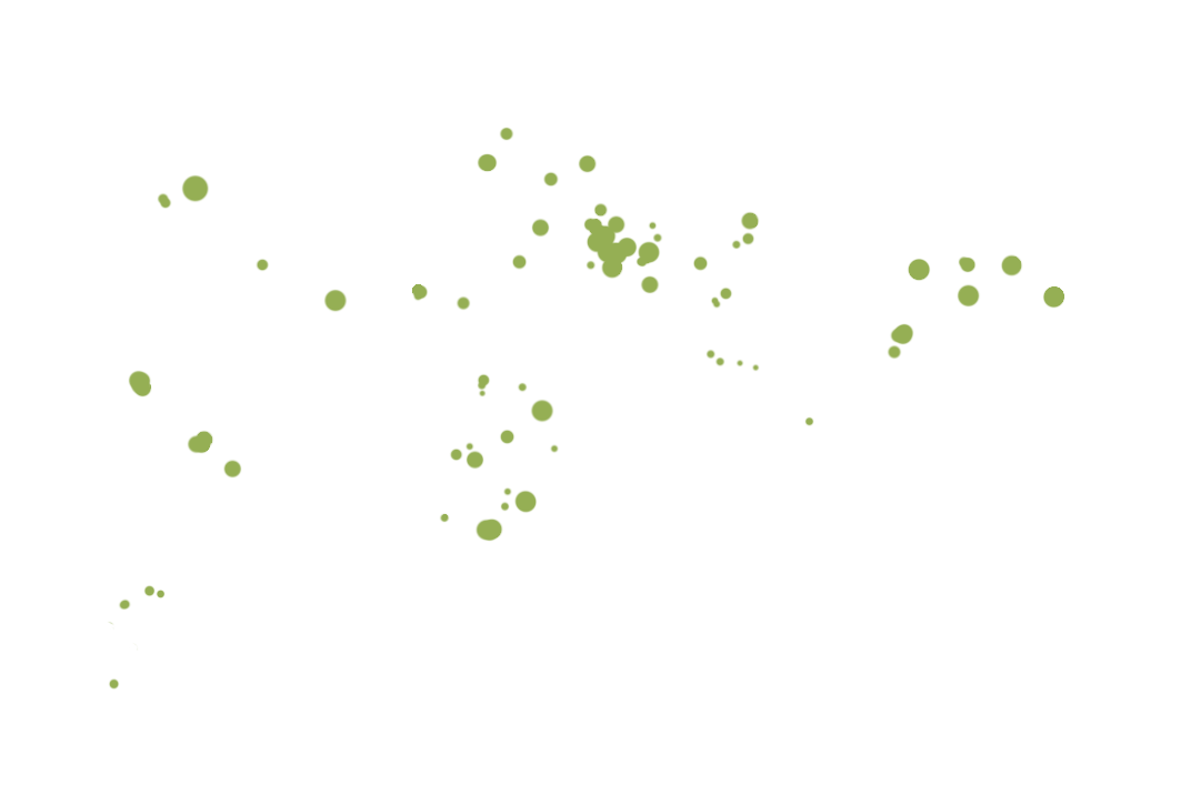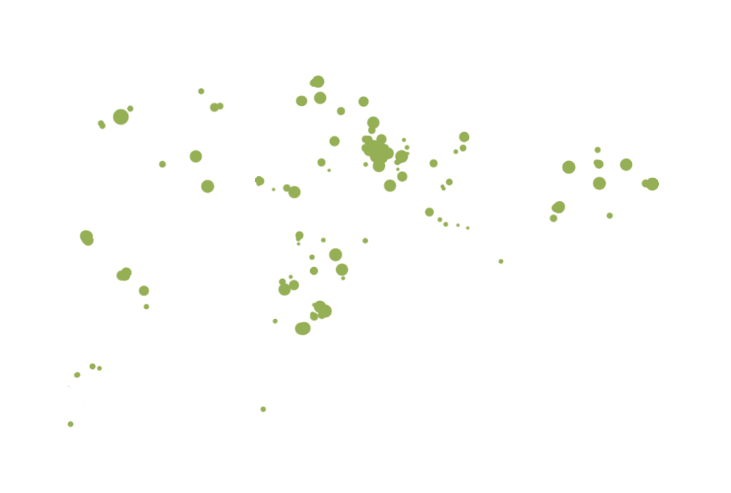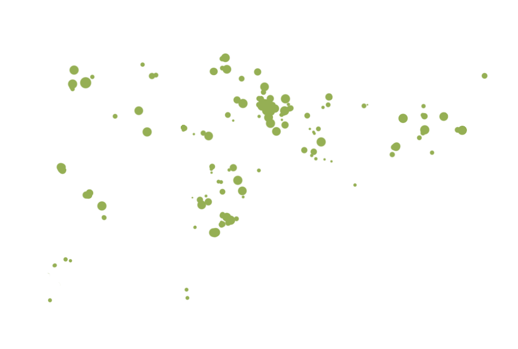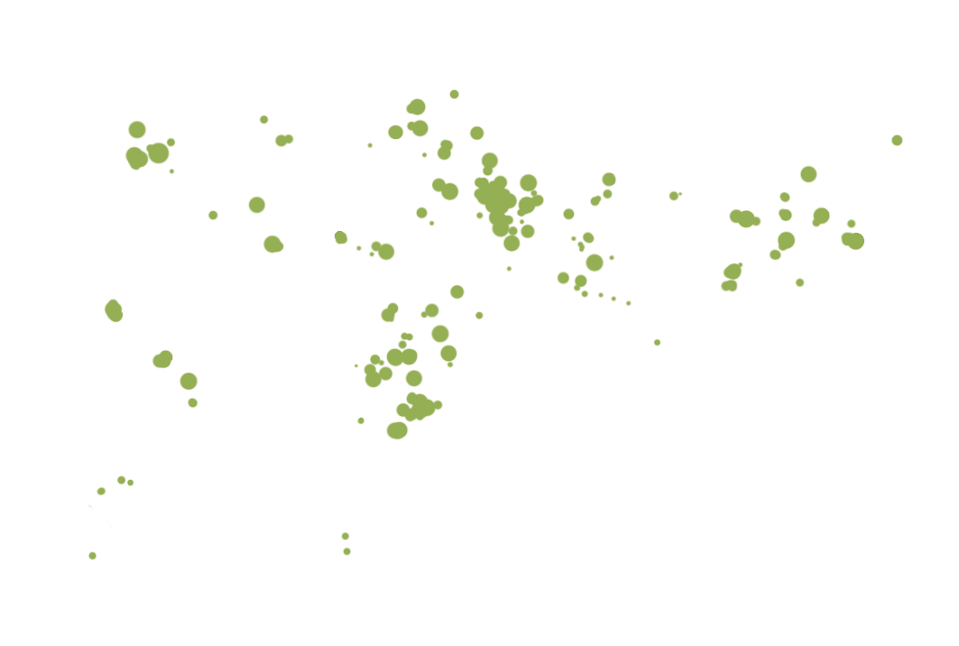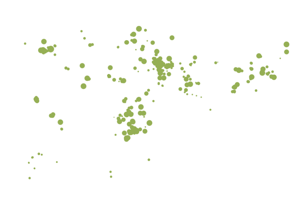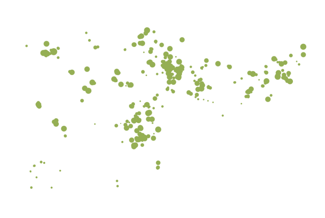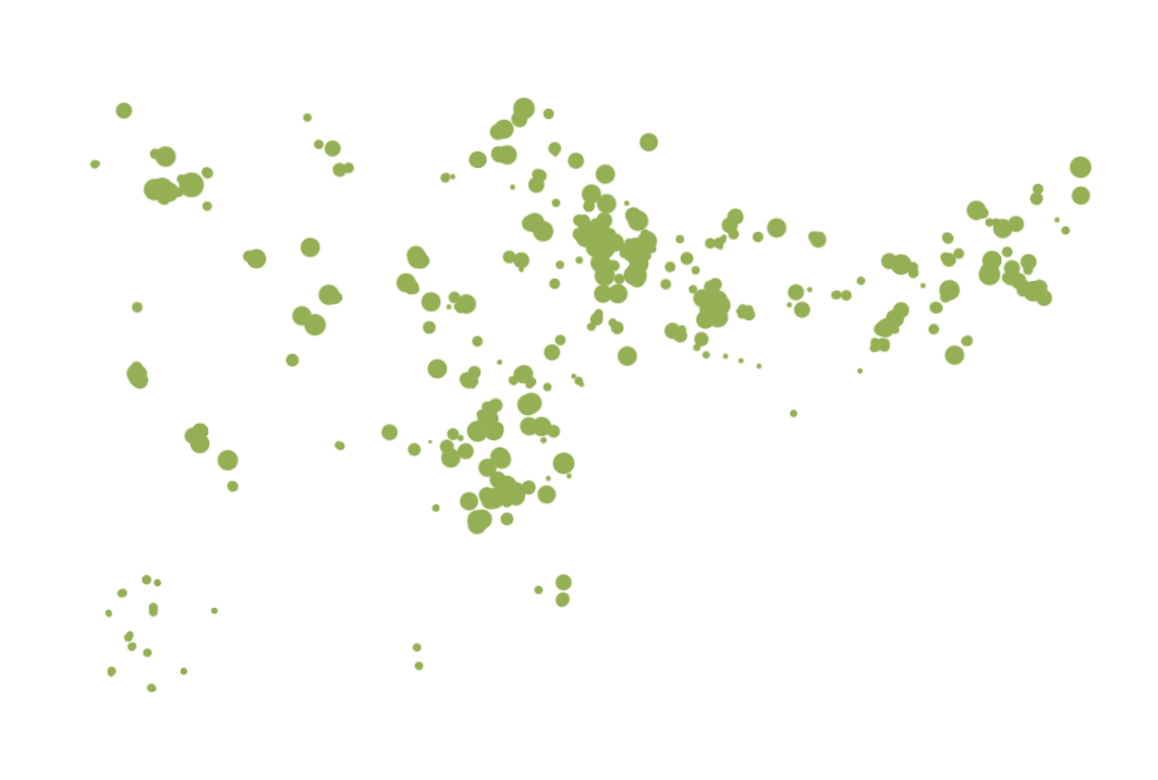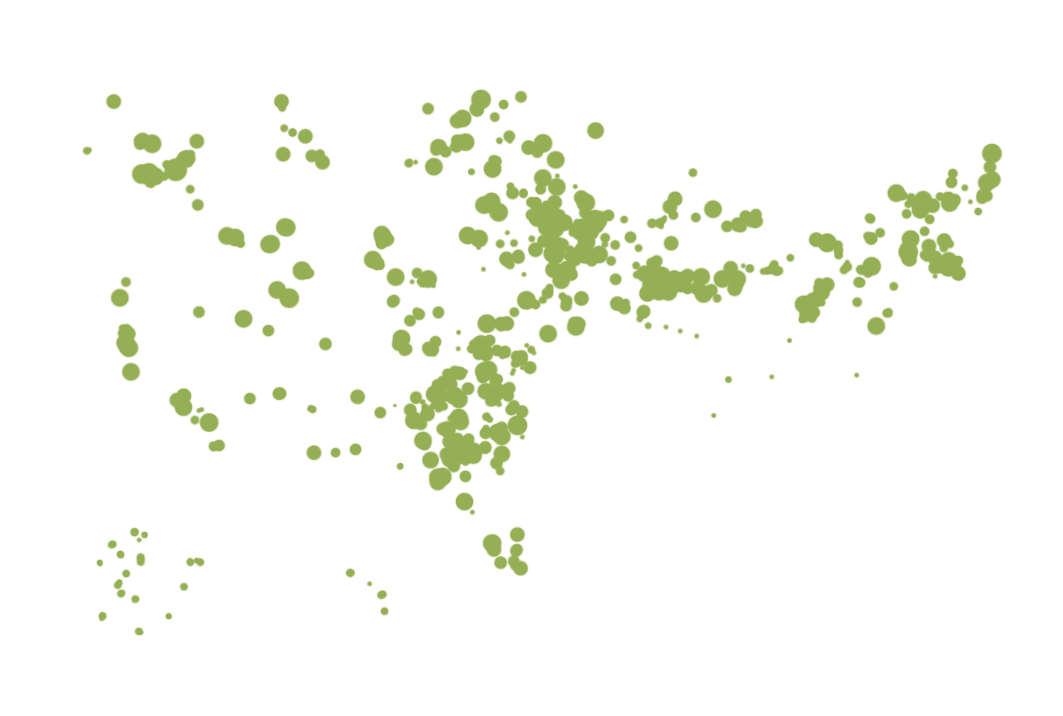
With data from the Federal Aviation
Administration, the U.S. Geological Survey
and Google Maps, we've mapped wind
turbines across the country. See the growth
over time and more details with a look
Inside the
Numbers.
BY EMILY LE COZ
Photos: A collection of submitted images and others taken by our
team of wind turbines across the country.

- 2000
- 2001
- 2002
- 2003
- 2004
- 2005
- 2006
- 2007
- 2008
- 2009
- 2010
- 2011
- 2012
- 2013
- 2014
- 2015
- 2016
- 2017
- InteractiveInteractive